Thursday, May 31, 2012

Ketchikan, May 19 – 24, 2012: Catching our Breath

What to say about Ketchikan?  Well, first I’d like to say: noisy.  But it’s not just that, no, it’s so much more - loud, raucous, nerve shattering sound all day.  There is one main north-south road and no major east-west arterials  as Ketchikan  is enclosed by mountains on the east and the Tongass Narrows waterway  on the west.  So the truck and bus noise is amplified as it bounces off the rock cliffs.  And the sea planes  are constantly landing and taking off - a cacophony of engines. 


Cruise Ship Leaving Ketchikan

The cruise ships are  relatively quiet, even though they are about two blocks long and 10 stories high.  Downtown Ketchikan, a cute waterfront – they sell really good popcorn -  is ruled by the passengers.  Businesses open at the arrival of the first ship and close when the 
last one of the day departs.  And that time changes daily.  If you ask merchants their hours, they’ll tell you they are open when the ships are in.  Period. 
Dinner Outing - Yes, Very Cold


Having made such a push to get here, we  are happy to stay put for a few days and take  care of business, boat maintenance, catch up on e-mail and re-provision.  Plus, there is a Starbucks near our marina so daily caffeine junkets are on the schedule. We meet up with our boat buddies and cocktail companions who arrived a day after we did, and exchange cruising strategies and destinations. 

I'm Looking at You!

Creek Filled with Salmon?
Ward Lake


We feel a little sluggish after being on the boat so long and decide a walk is in order. We  hop a bus with Zippy (stuffed in a duffel bag as we have no carrier)  to a trail north of town leading around picturesque Ward Lake.  It’s a bracing hike in the pouring rain – Jim insisted it was a drizzle, but  conceded it was heavy – yes, it was heavy enough to  drench us, and happened upon an eagle perched over a rushing waterfall, waiting for the first salmon in the spring migration.  Our moment of zen in the city.
Zippy Travels Ward Lake in Style


Totem Pole Pake

A few good dinners and a little sightseeing later and we are ready to leave and see the real Alaska.

Wednesday, May 30, 2012

Prince Rupert to Ketchikan, May 17 – May 19; Back in the USA


Hauling his Blue Truck


Prince Rupert
The cruise from Baker Inlet to Prince Rupert is reminiscent of the Queen Charlotte Sound crossing; worse conditions but shorter duration.  Stormy winds kick up ferocious waves that toss our boat around like a bathtub toy.  Nevertheless, no one gets ill and we arrive unscathed in Prince Rupert  four hours later. 

This is the last stop and town in BC before entering American waters.  Like so much of British Columbia that we have visited,  it once  had a thriving economy based on the lumber industry but the pulp mill closed and its biggest source of revenue is now the large fishing fleet and some tourism,  although locals say the cruise ships have  stopped coming.   It has a  population of approximately 12,000 and from what we’ve witnessed, the eagle population is even greater.  They’re like crows continually swooping above us. 

Our Last Evening in BC


Our new boating buddies and cocktail companions, Terry and Hans & Gay and Wyman are also here in “Rainy Rupert” and so we have…cocktails, and prepare for our voyage to Chatham Sound and across Dixon Entrance, the last of the Pacific Ocean waters we must traverse to reach Ketchikan.  A weather front with high winds is moving in and we have to skedaddle on Saturday May 19th or we will once again be weather prisoners.

We awake to sunshine (although a local says that sunshine is a light drizzle so I'm not sure what they call  this ) and pull out of the moorage slip at 6:05 AM, full daylight in these northern latitudes.   It is  glassy calm trip across Dixon Entrance - Gay later said that we would never see Dixon Entrance that calm again – oh no, we have to go back home that way.  We're elated when we cross the "border" and  re-enter American waters, reclaiming our Bill of Rights.

Right side - BC; Left side, US


Ten hours after our departure, we reach Ketchikan, home of the cruise ships.  The waterfront is littered with 3 -5 ships every day -  7 days a week.  The local paper posts a daily schedule of the names of the ships, arrival and departure times, and number of passengers,  anywhere  from  8,600 people to a mere 2,000 per day.


Jim & His First Mate Monitoring Re-entry


The First of the Cruise Ships


The sun is shining when we arrive, an equally unusual occurrence in this rain forest  that sees approximately 160 days of rain a year.  It could be pouring hail-balls and we wouldn’t care, we are so astonished that we’ve actually made it all the way here.  And so quickly it  now seems.  We aren’t  in the San Juan Islands anymore, we've crossed great oceans.!  We're water warriors.. 
Ketchikan


We mark our arrival with a great dinner at the foot of the harbor and celebrate with a bottle of Champagne.  Alaska at last.


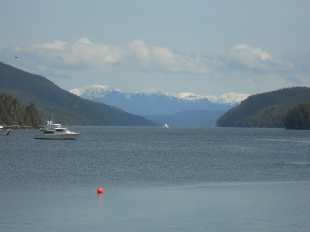
Ketchikan Waterfront

Baker Inlet, May 16: An Anchorage in Heaven

Amazing
Crab Pots Heading North


Today is our first Orca sighting, three of them, right next to our boat.  Their perfect synchronized swimming would earn them at "10" at the Summer Olympics.  We decide then and there to buy a new camera with a telephoto lens. 


The Captain and his First Mate Manning the Couch


After 8 plus hours on the water we duck into Baker Inlet for the night.  During the day, we’ve talked to Hans and Terry on the radio, one of the couples we met while  weather hostages in Port McNeil.  They're  also heading to Ketchikan and are just a few miles behind us so they decide to join us at this anchorage. 

Trip to Baker Inlet
The Baker Inlet entrance takes us through a narrow, rock lined, “S” shaped passage wide enough for exactly one boat.  Fog has started to settle and this remote  anchorage, accessible only by boat, is drenched in a beautiful steel blue hue.  Four miles later, at the head of the inlet , we're greeted by a black bear  prowling the water's edge.  Two other boats are already anchored here, one of them, Safari, is owned by  the smart couple who crossed  Queen Charlotte Sound a day after we did,  avoiding the rip-roaring ride we had.  Before we've even dropped anchor, Gay hails us on the radio to announce cocktails in 30 minutes. 
The Entry

Terry and Hans have now also arrived and everyone launches their dinghy and makes a bee line for the party boat.  It turns out that Terry and Hans are friends with Gay and Wyman (they are all Californians) and are actually traveling to Ketchikan together.   We gain some great local knowledge from Gay and Wyman as they have cruised Alaska several times.  And here, in the middle of nowhere, we have drinks and appetizers worthy of a first class restaurant while the rain falls and the bear grazes on shore.  

Our Home for the Night

Finlayson Channel, Tolmie Channel, and Graham Reach, May 15: Waterfall Alley to The Ruins


Morning Sun
From Shearwater it’s a nine hour run – or shall we say putter, at 8.5 knots - up the coast through miles of a beautiful mountain lined waterway - a blue ribbon through  narrow passages of green walls of wilderness sprinkled with waterfalls.  There are so many we actually stop yelling “look, look!”  It’s the happy version of shock and awe.


Our First Waterfall
And Another One


Last One - Promise

After 9 hours we're tired, it’s getting late and anchoring possibilities are limited in this remote area so we stop for the night in an old abandoned fishing and lumbering community on Princess Royal Island.  The guidebook warns that it’s in disrepair but doesn't prepare us for the extent of the decay.  After a sunny day of eye-popping beauty, we turn the corner, enter the bay and are met with a scene worthy of a slasher movie.  Ramshackle buildings toppling down the hillside, overgrown vegetation and lumber debris strewn everywhere.  This is equally eye-popping,  in a different kind of way – nature is aggressively reclaiming the landscape.
Yikes!
We are momentarily stunned but as promised by the guidebook, there is a “dock” – wobbly and  lopsided, just  skimming the water.  The dock is anchored to land by some logs in the water that are tied with some frayed rope to something on shore, rocks maybe -  we’re really not sure.  There is a small power boat tied to it and since it’s too late to go anywhere else,  we also tie up and hope for the best.  An abandoned power boat and small rowboat are  perched on the rocks about 10 feet above us, looking  like they will catapult straight down onto us.  

Our Dock


Picturesque Butedale
There is a rumored “caretaker” and one of the buildings looks occupied -  smoke is coming out of a chimney and underwear and socks are hanging on a clothes line to dry - but the only signs of life we see are a black bear combing the shore.  On the plus side, it’s real quiet  and there’s  no moorage fee. We later learned from some other boaters that the caretaker charges boaters 75 cents a foot for the hospitality of  a Butedale moorage. 


Wednesday, May 23, 2012

Shearwater BC, May 13, 2012: A Nature Adventure

Our outboard dinghy engine still needs fixing so we set course for Shearwater on Denny Island, one of the last places on the BC coast that has a settlement, a marina and a mechanic – of course, that comprises most of the town. 

Wolf Failing to Yield Right-of-Way
On our cruise there, we traverse the narrow but charming  Gunboat Passage,  so skinny  and twisty  that getting the boat through is like threading a needle with boxing  gloves on.  It is lined with small islands  for miles and miles. 
 At the tail end of our passage we notice unusual  traffic in the channel , a wolf is swimming  directly in front of our boat, crossing from the island on our left to the island on our right.  We stop, as he clearly  has no intention of yielding  to us even  though we have  the right of way.  He slowly crosses over to the shore, where he clamors out of the water, over the rocks  and onto  the  stony beach.  He  shakes  off the water so vigorously I can almost  feel the droplets landing on me.  After taking a moment to catch his breath –he seemed a bit out of shape with all that panting – he turned, looked straight at us and then walked into the woods and out of sight.  He never even thanked us for allowing him wide berth in the channel.
Wet Wolf
Big Beaked Edgar


Once we are safely docked at Shearwater, no sooner are we on land than we’re buzzed by Edgar, the eagle.  He flew so close and low we felt  the wind whip  around us from the flapping  of his wings.  The locals had named him and assured us he had no interest in Zippy, but every time we left the boat during our stay there, Edgar stood watch, beak  poised for things I don’t even want to think about.   

On Monday morning Kevin the mechanic quickly fixes our outboard motor.  We now have all systems working.  Our water maker has performed flawlessly, taking saltwater and desalinating it into water so pure we can drink it.  We are ready to forge onward.

Harbor at Shearwater
Evening in Shearwater

Thursday, May 17, 2012

Ocean Falls, May, 12th, A Ghost Town

The trip to Ocean Falls

 After reluctantly departing Pruth Bay we decide on a side trip to Ocean Falls, off the beaten track, leading nowhere else and a deliberate destination choice. 


The approach is impressive with a high-rise in the center of town and a waterfall cascading from a dam.  Not even in Campbell River, population of 2,700, did we see high-rise buildings.  Turns out, however, that these building are vacant.  Windows are blown out, houses half gone, walls collapsed and a shower door swinging in the breeze.  This is a modern day ghost town – population 6-8, depending on whom you ask, number 6 or number 8.

Cousins Channel Entrance


Ocean Falls


Back in the early 1900s this was a booming metropolis with a saw mill, a population of 5,000  and a school with a billiard room and saloon – and I mean in the school. Now, the dam predominates and makes electricity for nearby island communities.  A fishery has also opened but other than transient workers, the town remains deserted.

Walking off the dock onto land, a sign points to a grocery store – hours Monday, Wednesday and Friday, 3 PM – 5 PM  -  as well as to a bar in the neighboring town of Martin Valley, population 25 – 40, depending on whom you ask.  Being a Saturday night, Jim and I decide to hike over to the bar – seems like a friendly thing to do, plunk down a few dollars for a brew or two and pump a little cash into the community. It’s about  1 1/2 miles and we are parched by the time we arrive but  alas, the saloon is closed.  Well, it is only 7PM, maybe they catch a later clientele.  No, we find out from a local, they cater to the grocery crowd, the bar being open Mondays, Wednesdays and Fridays.
View from our Walk


So Many Choices - So Little Time

Back in town we chat with the new owners of Darke Waters Inn, 5 of the 8 Ocean Falls residents.  They are an enthusiastic couple, already lodging 10 loggers and fellers – and don’t call a “feller” a logger.  

They hope to have an adventure themed retreat but with the absence of amenities and the abundance of rain – it is the wettest spot in BC with an average of 14.5 feet – yes, inches are just not sufficient  to measure the volume of water pouring down on “the rain people”- and a destination only accessible by boat or float plane, they may be overly optimistic.  

And really, they need to clean up that large pile of fresh bear scat in the middle of the road, for a number of reasons, if they want to attract tourists.  And we hope they do at  Darke Waters in Ocean Falls.
Electrical Outlet Boxes

Pruth Bay, Calvert Island, May 10 & 11: Paradise Found

Anchoring – this is what I have dreaded leading up to this trip and now we are in a secluded and remote bay that requires we do it.  I’ve given myself pep talks and used positive visualization techniques and all I can really picture is us tied to a dock.  And this trip is all about anchoring in the wilderness, not docking in cute island towns.  

So after our 9 hour, mostly grueling, passage from Port McNeill, we are now faced with this.  We’re at a perfect looking spot in 60 feet of water near the shore and Jim heave-hos the anchor and 225 feet of chain follow it down the drink until it grips the mud and we’re set.  But are we really?  I can’t see that anchor down there and now my visualization skills  kick into high gear and I see  us floating away.  And that’s what keeps me awake at night.

View at Twilight from our Anchorage in Pruth Bay


Pruth Bay
The next morning we are still in the same place as we were last night when we went to bed so I calm down and we jump into the dinghy with Zippy and motor around the corner and over to the head of the bay.  This is the site of an old fishing lodge that has been privatized by a foundation that opened the Hakai Beach Institute, an environmental organization.  They have cabins that house students from various universities as well as archeologists engaged in research.

Remote and Raw
Our own research takes us across a public path to the west side of Calvert Island to a cove  that is inaccessible by boat, plane or car.  To say that it is spectacularly gorgeous is to diminish its beauty.   We spend a couple of hours walking  the remote beach and exploring in sheer wonderment.  We later found out that if you sit on the driftwood and wait, wolves wander onto the beach. Even Zippy understands the magnificence of the place demonstrating an enhanced level of enthusiasm – or maybe it was just that he was happy to be off the boat.  


Enjoying the wilderness


On the way back to the boat, our dinghy motor fails and just to show what a state of Zen we’re in, we simply shrug.  Several hours later, after Zippy is jumping in circles and crossing his legs, it dawns on us that we have no way to get Zippy to shore for potty duty – but wait – we have the Loo-Liner.  

The homely orange float, which we brought with us for just such an eventuality, is worthless.  It sits too low in the water, is unsafe for the three of us and it's too tippy for Zippy, or us.  We snap to plan C;  kayaks to the rescue.  So every time Zippy has business on shore, we paddle – 20 minutes to shore, 20 minutes back from shore – 20 minutes to shore....  we’ve got to get that dinghy motor fixed.
Seals Watching our Paddling to and Fro
 After two nights anchored in this peaceful and picturesque spot where we are the only boat, I have to reevaluate my entire anti-anchoring position - which I will do next time we are securely docked. 

Leaving Paradise


Queen Charlotte Sound: Held Captive No More

“A great, great deal has been said about the weather, but very little has been done about it.”              Mark Twain

On night 5 in Port McNeil – but who’s counting - one of our dock mates holds a strategy session on his boat to determine the best time to make a getaway through Queen Charlotte Strait and across QC Sound (the Pacific Ocean).  Unfortunately, gale warnings are still being issued.  The couple invited us over, as well as another boater from our dock who presents an elaborate drawing he made on an 8 x 11 inch piece of paper showing the islands, the water, the wind, the waves and us.   Arrows are pointing every which way representing the seas and the directional wind.  It's like a mini-meteorology tutorial given by, well…, a couple of guys in a boat. 
Our self-appointed leader robustly opines, fueled by the half empty bottle of Glenlivet sitting in front of him, that 10-20 mph winds with 2 meter seas at 9 second intervals is not safe but at 10 second intervals it is very “doable.”  He would leave the next morning.  The other boater nods sagely - Jim and I leave the confab.  My opinion, fueled by common sense, is that I can get equally sick at 9 seconds or 10 seconds – very “doable.”  

Mr. Glenlivet did not leave the next morning.
42 Degrees Just Shouts -  Sunbathing

When we first arrived in Port McNeill, we were the second boat in the marina, but, as the weather front hovered, more boats dribbled in.  By Thursday, day 7 for us, and we are counting to the minute, the gale warning lifts and there is a flurry of activity on the dock at 6 AM as six of the seven boats prepare to leave.  We are all suffering cabin fever and dockitis.  Jim and I push off first at 6:15AM.


Our Last Evening in Port McNeill


We look like a flotilla leaving, one right after the other, and we travel in a line for quite some time until we take different courses.  It all started out quite calm, but, gradually, the seas started building and building until we were in the middle of rollers 12 – 15 feet.  I felt like I was in a scene from The Perfect Storm – only George Clooney was not at the helm, just a very pale Jim. 

The Flotilla
We have fallen to the rear
 It was so bad that the cats got sea sick and since Jim was already feeling queasy, even with the patch on, I was dispatched to go below and swab the decks - as it were.  Needless to say, after breakfast and the unfortunate clean-up duty, I was a little pasty myself.  But a mere 7 hours later we were in the protection of Calvert Island and smooth seas once again prevail. 

Two days later we ran into the 7th boat that didn’t leave with us from Port McNeill.  They waited to cross Queen Charlotte sound until the following day when it was glassy calm.  I guess you just can’t do anything about the weather – except wait and be patient – which we will be next time.

Now you see him...


Now you don't
Swallowed by the Swells